
The street directory works best as a chain of official sources, not as a claim that every Lake Stevens household appears in one list. Each street directory result must retain the role stated by its custodian.
Walk a Lake Stevens Street
A street-by-street search begins with the official form of one address. USPS confirms the delivery wording, while the Snohomish County Assessor connects that wording to a parcel. The parcel is the bridge to nearby lots in SCOPI, the account summary, and instruments in the Auditor's index. This order keeps a mailing address or similar road name from being mistaken for the land itself.
- Confirm the full delivery address, including direction, unit, and ZIP, with USPS.
- Enter the number and street in Assessor Property Information. If it fails, remove the street type or direction, then try the street name alone.
- Save the parcel number and open SCOPI. Click nearby parcel shapes to browse the named street without treating adjacency as proof of a household.
- Use the parcel, legal description, or party name in the recorded-document portal. Keep each recording date and instrument type.
- For older names, check Everett-area and county directories, whose collections are detailed on the Lake Stevens city directory page.
This Lake Stevens street directory trail is not a ready-made roll. An owner can live elsewhere, and a recorded party may never have occupied the parcel.
Normalize Lake Stevens Street Addresses
The Snohomish County Assessor Property Information search accepts one criterion in one field. It can take a 14-digit real-property parcel number, a 7-digit personal-property parcel number, or a street address. A street name broadens the results, a full number and street narrows them, and the asterisk is a supported wildcard. County instructions say to spell the road name fully and try it without the type or direction when the first query misses.
| Search key | Format | Best use | Limit |
|---|---|---|---|
| Real parcel | 14 digits | One land account | Not an occupant key |
| Personal property | 7 digits | Personal-property account | Different record class |
| Street name | Full name | Broad by-street scan | May return many parcels |
| Number and street | Number plus full name | One situs address | Try less detail if missed |
| Wildcard | Asterisk | Partial matching | Review each candidate |
Open the live Assessor search before relying on its captured screen, since portal wording can change.
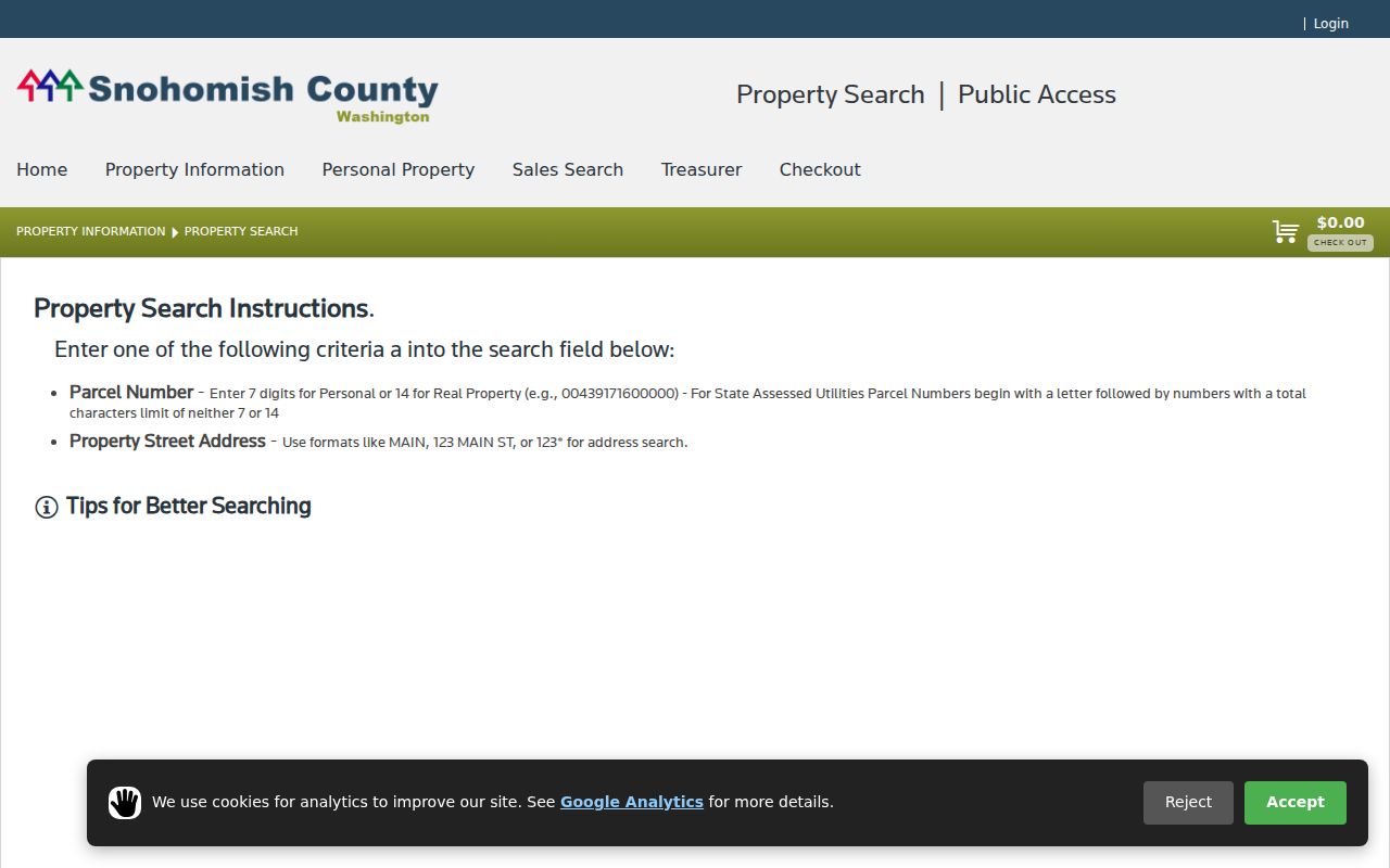
The image shows the single search field and address tips. It does not show a live occupancy field.
Lake Stevens Records by Address
Each record answers a different question. The Assessor and Treasurer describe property and tax roles. SCOPI supplies map context. The Auditor preserves instruments. The City archive may expose a project, permit discussion, subdivision, or annexation record when searched by street or project name. Washington voter data is held at the state level and comes with limits.
| Address source | Keeper | What it can show | Access channels |
|---|---|---|---|
| Parcel account | County Assessor | Taxpayer, situs, parcel, value, structure | Portal, phone, county office |
| Parcel map | Assessor GIS | Shapes, house labels, aerials, nearby accounts | SCOPI, GIS support |
| Recorded instruments | County Auditor | Parties, dates, type, parcel, legal description | Portal, terminal, mail, staff, microfilm |
| City project records | Lake Stevens | Permits, planning, agendas, project context | Archive, permit portal, records request |
| Voter data | Secretary of State | Restricted public registration fields | Self-lookup or state extract request |
The records may connect through parcel, address, party, or date. They should not be flattened into one claim about Lake Stevens residents.
Map Lake Stevens Streets in SCOPI
SCOPI Interactive Map lets a reader click a parcel, review a list, and open Property Account Summary. The summary may show taxpayer, gross acres, market value, tax code area, sales and tax history, legal description, and structure data. Layers add parcel and house-number labels, appraisal neighborhoods, recent sales, and aerials from 2017, 2018, 2020, 2021, 2022, and 2024.
Use the map to move along a street, but call every hit a parcel or nearby address. Shared-interest land may have several parcels. “Multiple Parcels” warns that the account needs closer review. The recent-sales layer begins January 1, 2024 and excludes several nonmarket, estate, gift, quitclaim, and multi-parcel transfers. It is context, not full title history.
Note: Map boundaries aid discovery; an official property record and recorded instrument are stronger evidence for a legal property claim.
Read Lake Stevens Address Labels
A street directory fails when unlike labels are treated as synonyms. “Situs” means the physical property address. A mailing address is where tax mail goes. “Taxpayer” names the party on the tax account. An occupant lives at the place. None proves another.
- Parcel
- A numbered unit used to identify land in county systems.
- Situs address
- The physical property address, which may differ from the taxpayer's mailing address.
- Plat
- A recorded map laying out lots, roads, and boundaries.
- Criss-cross directory
- A historical directory arranged by address or phone, not only surname.
The Treasurer Tax Search makes this plain with separate Property Address and Mailing Address modes, plus parcel and taxpayer-name searches. Preserve the label in the result. Never turn it into a household statement.
Follow Lake Stevens Deeds by Street
The Search Recorded Documents portal accepts Name, Document type, recording number or ARN, recording date, Parcel ID, Book and page, and Legal description. Name search separates last and first name. Parcel search uses the first ten digits, while plats, surveys, and condominiums belong under Legal. Since March 2, 2026, the county requires a free account.
Visit the live recorded-document search to check its current categories.
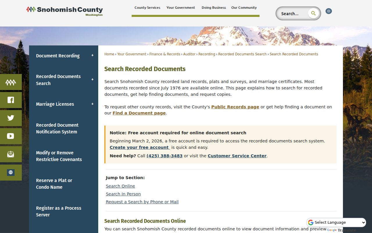
The image shows how a by-address search can move from a parcel to a deed, plat, survey, lien, lease, or related record. A named party is not necessarily a resident.
Most documents since July 1976 are online. Unofficial copies are described as immediate, and certified copies are mailed within five business days. If online access fails, use the public terminal or staff in Everett, send a copy request by mail, or request a staff search. Bring party names, parcel or legal description, document type, and a date range.
Lake Stevens Streets Before 1976
A blank portal result does not end an old search. Most pre-July 1976 instruments are on microfilm at the Snohomish County Auditor Recording Division, 3000 Rockefeller Avenue in Everett. Call 425-388-3483 or email recording@snoco.gov. County materials describe online, phone, mail, and in-person paths. Staff research is listed at $8 per hour, while current copy charges should be checked when ordering.
An early instrument may use a party, book and page, plat, addition, or legal description instead of today's street form. Bring every parcel key found in later records. The Washington Digital Archives land index offers a second name-and-year path, although image access varies by hit.
Insider tip. Start with the newest verified deed, then carry its prior party, legal description, and recording reference to the microfilm counter.
Old Lake Stevens Street Names
Lake Stevens changed through repeated annexations. An older record may use an Everett-area heading, former community label, or county name rather than today's city. The city's 2013 honorary-street resolution adds a useful clue: historic and honorary names can coexist with numbered streets, but do not alter the official address.
Keep both forms in the search log. Use old wording in directories, newspapers, and archive text, but use the official current form for USPS, the Assessor, and city forms. The Lake Stevens archive has keyword, category, time-period, and date-range controls. A project, subdivision, or road variant may find planning records that a current address misses.
The city annexation history maps label growth areas across many different years, including the original 1960 city and later areas through 2022. Those maps help explain why the same road may sit under a county label in one record and a city label in another. They should not be merged into a homemade parcel-by-parcel date table. Instead, note which city map was checked, its displayed annexation label, and the separate date of the deed or directory entry. Postal service, utility service, school districts, and city boundaries can also describe one Lake Stevens address in different ways.
Lake Stevens Voter Street Limits
A voter record is not an open block roster. VoteWA self-lookup asks for exact first name, last name, and date of birth. For a database extract, Snohomish County directs requesters to the Secretary of State request process. The form gathers requester details, one file choice, counties, and agreement to the rules.
Public fields and use are restricted. Protected voters are not public, while full birth dates, driver-license or ID numbers, and Social Security numbers are protected. The Address Confidentiality Program may supply a substitute address. Even an allowed street-level file reflects registration, not all current occupants.
Note: Record the file date and access terms because voter data changes, and never infer a whole Lake Stevens household from it.
Limits of Lake Stevens Street Lookups
No office publishes a complete Lake Stevens street directory of everyone who lives along a road. Parcel tools identify property roles, the Auditor identifies recorded parties, and old books preserve dated snapshots. Renters, relatives, and other occupants may be absent. A trust or business may own land. An address may be stale, protected, or tied to mail elsewhere.
Use two records when identity matters. Note the native key, record date, search date, role, and custodian. Request an official copy when an index is not enough. “No result” can reflect spelling, dates, an archive gap, or confidentiality, not proof that a person or property never existed.
Lawful use. Lake Stevens address records support personal research, property history, and civic questions. Never use them to stalk, harass, threaten, or expose a protected person.